31 March 2026
Coming soon: Geometry API
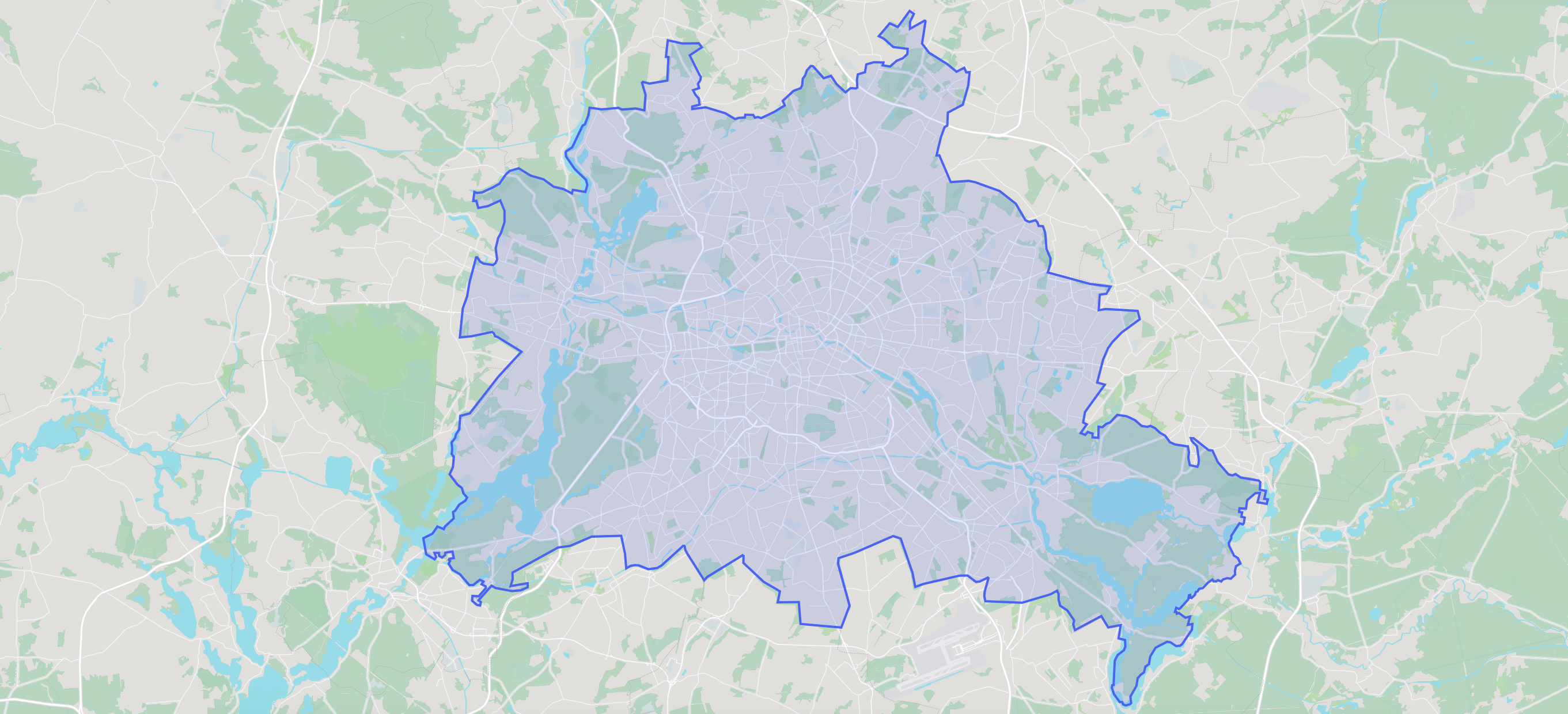
You’ll soon be able to retrieve high quality geometry information for the boundaries of countries, cities, and other administrative areas from our new Geometry API! Early access sign ups are open now.
Since our inception, we’ve been using polygon boundary data extensively to power our geocoding service, but until now we’ve never made that data available directly via API.
Soon you’ll be able to easily retrieve boundary polygons from anywhere in the world, with several different fidelity levels for different purposes, all served via our lightning fast global network.
What can you do with geometries?
Geometries can enhance your interactive maps with fidelity and details that point-based results simply can’t. Why just zoom to the centroid of a city when you can show the entire city boundary?
These days, with modern map rendering libraries like Maplibre, it’s essentially effortless to render even large, complex polygons on your maps.
You can even perform complex geometry operations like point-in-polygon, buffering, and more that used to require something more powerful like PostGIS right in the browser with Turf.js or other tools.
On the server side, you can use boundary geometries to efficiently associate your existing spatial data with cities, countries, or anything with a polygon boundary. You can feed the data into analysis tools like DuckDB to do all sorts of number crunching at lightning speed.
Best of all, like all our endpoints, our data sources allow you to cache or store these geometries for as long as you’d like.
All the details you need
Geometry data can be hefty, that’s part of the appeal: a single record might describe the extent of say, an entire country. Balancing precision with the size of this data can be a challenge. That’s why we make all geometries available in three different detail levels:
- High detail: suitable for use at extreme zooms or for analysis work
- Medium detail: still preserves enough detail to be almost visually identical at medium zooms, but with a greatly reduced file size
- Low detail: as small as possible while still maintaining a similar shape. Useful for conserving bandwidth on mobile devices or when displaying many geometries on a very zoomed out map
Finding parameters to fit these detail levels across all the different shapes and sizes of geometries across the entire globe was a fun technical challenge that we stewed over for quite a while. We think you’ll appreciate the results.
On the roadmap: Postal codes and POIs
We’ll be launching with support for administrative areas, but won’t be stopping there. In the future, you’ll be able to quickly fetch boundary polygons for postal codes and POIs like city parks, airports, shopping malls, and more.
Beta Testing
If you’re interested in being an early beta tester for the geometry endpoint, reach out to us! Invites are going out now for a general release in the next few months.

Image credit: City of Berlin polygon boundary by Geocode Earth.