09 March 2026
The exactitude of postcodes
A question we get all the time is: why doesn’t this street record include a postcode? Postcodes are one of those things people assume are straightforward but are actually pretty weird when you look at them more closely.
It’s a perfectly reasonable expectation. A postcode is part of an address, and streets are part of addresses, so why wouldn’t a postcode be attached to the street? It might look like a gap in our data, a simple oversight on our side. But what’s actually happening is more like a misalignment, an oversight in the way we understand addresses.
When you look at a typical mailing address it reads like a single, coherent description of a place. Street number, street name, city, state, post code. On the page, it looks like one clean, unified description. In reality though, it’s a unique set of conventions that mostly cooperate, but not perfectly, and not all the time. The address line looks coherent because we’re used to seeing these elements side by side. We’ve learned to read them as one thing, even though they weren’t designed as one. They only meet in this format because it works well enough to coordinate people, institutions, and machines. To see what’s going on, it helps to pull an address apart and look at each part a little closer:
Street Names
The street name references infrastructure. In most places it anchors the address to a named route through space that exists independently of any one building or landmark. It’s not something we usually stop to think about, but a street isn’t actually a place; it’s a description of a route between places.
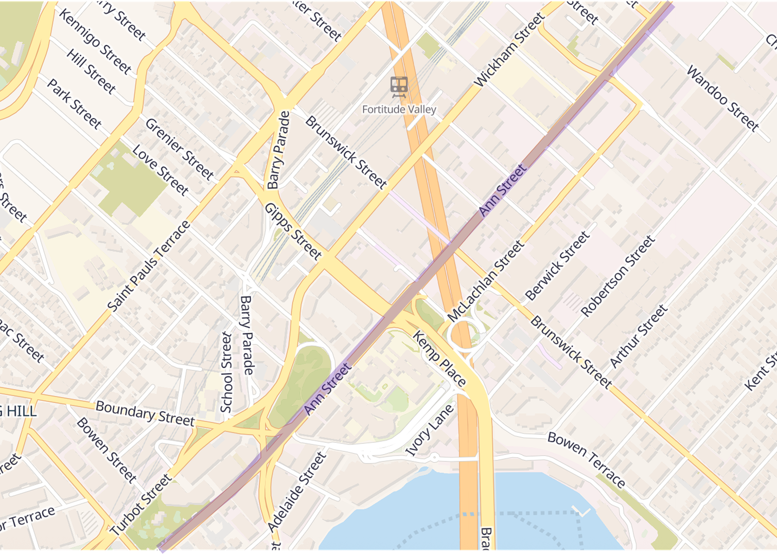
That’s why a single street can stretch for kilometres, span multiple suburbs, and pass through many different postal codes.
But street names aren’t always the unit an address is built around. In much of Japan, street names are not the primary reference in postal addresses, and many smaller streets are unnamed. Instead, locations are specified through areas, blocks, and building numbers, with the street network treated as background infrastructure.
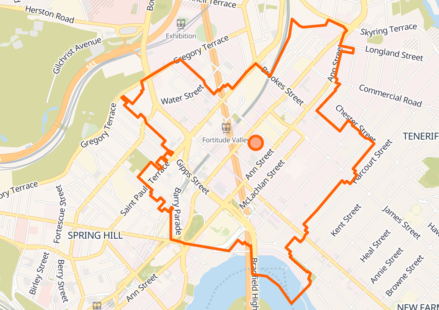
Note; All map examples below use Australian data, where postcode and locality boundaries are publicly available and clearly mapped.
House Numbers
The number adds a layer of precision to that street. It doesn’t describe an area at all, but a position along a line. If you live in an apartment building, this logic keeps going. The building number narrows the location, then the apartment number narrows it again. Each additional slash or number adds another layer of granularity.
Even street numbering isn’t universal. In lots of places, odd numbers run up one side and evens down the other, but some streets use older “horseshoe” or other schemes, sometimes with different systems within the same city.
City or Suburb
The city or suburb is where the address line zooms out and starts describing jurisdiction. Even the label for this part of an address turns out to be regional: city, suburb, borough, district, or locality, depending on where you are. These boundaries aren’t natural features of the landscape. They’re human-made lines that determine where services, responsibility, and belonging are assigned. Sometimes they follow something obvious like a river or a major road. Often they don’t. More often they’re inherited, shaped by older land divisions and planning decisions. Even when they’ve outgrown their usefulness, they persist because changing them can be disruptive and politically expensive.
It’s also worth separating official administrative divisions from the more informal labels people use day to day. Councils and boroughs tend to be sharply defined. But below that level, boundaries often become colloquial and contested. Neighbourhoods exist socially, but not as precise polygons. In Berlin, a borough and district are formally defined, while a “kiez” is more like a shared sense of an area around a square or park. New York neighbourhoods are similar. They are widely used, frequently debated, and sometimes “creatively” stretched by real estate listings.
Postal Codes
Postal codes were the last layer to arrive; they were invented to deal with scale and operate on a completely different logic. As mail volumes exploded, postal services needed a way to sort and route efficiently without relying on local knowledge. Postcodes describe delivery systems, grouping together addresses according to how mail actually moves. That’s why they often cut across neighbourhoods, split streets, or behave in ways that feel unintuitive from a geographic point of view.
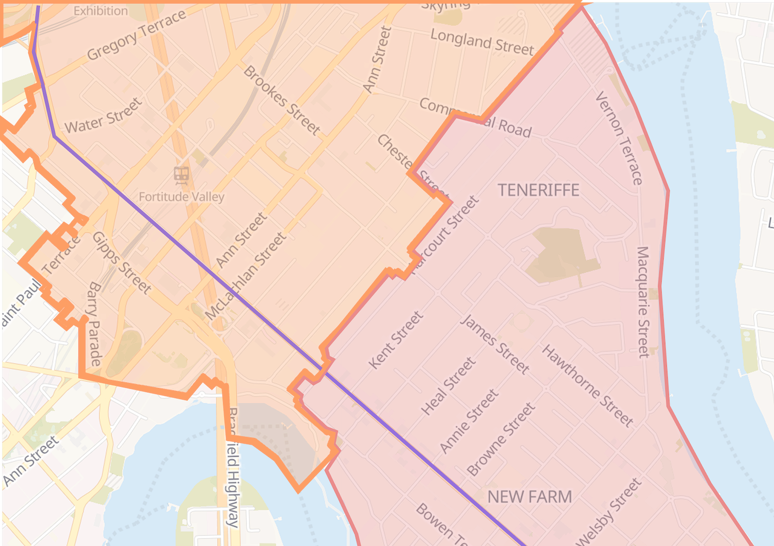
This is also why post codes show up so often in “edge case” writeups. The moment you treat them like clean geographic shapes, you start tripping over gaps, overlaps, and odd exceptions. That’s also where people get into trouble when ZIP Codes are treated as the primary geographic identifier for a person or place. They’re convenient, widely available, and easy to aggregate, but they were never designed to describe stable regions of space. Once you see them as routing, some of those odd cases start to make sense.
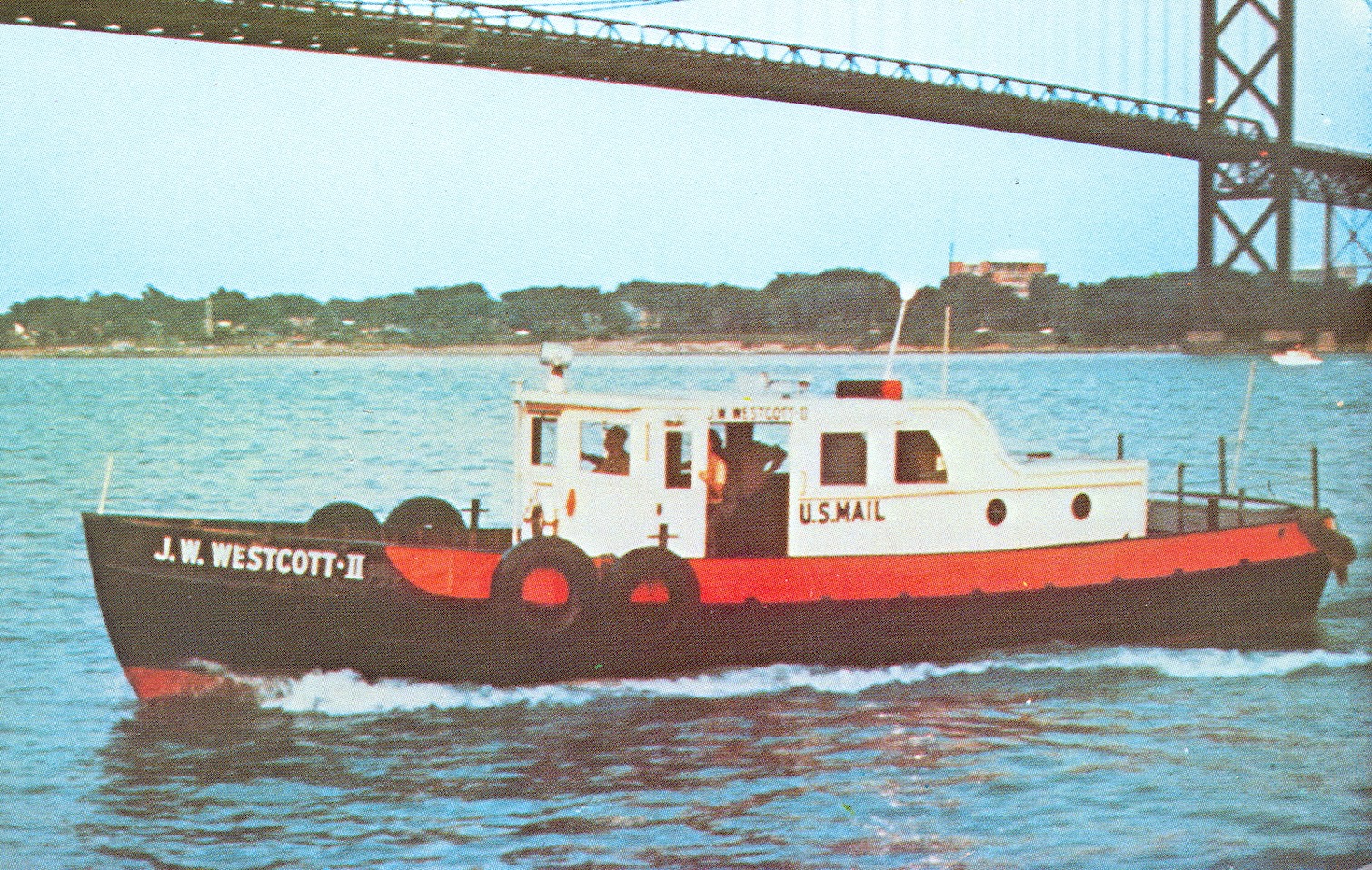
Postal codes can be reassigned, split, merged, or retired as delivery networks and mail volumes shift. In the US for example there is a single floating ZIP Code, 48222, assigned to the J.W. Westcott mail boat that delivers mail to ships on the Detroit River. A “postcode” can move because the thing it identifies is a delivery operation, not a fixed patch of land. The same logic is why some large buildings are assigned their own ZIP Code, like the Empire State Building.
The UK is a nice contrast because the format encodes more structure. A full UK postcode is split into an outward code and an inward code (for example, “SW1A 1AA”). In dense areas, the smallest unit often corresponds to a street or part of a street, and sometimes even a single organisation or property, depending on mail volume.
So why then doesn’t this street record include a postcode?
Because a street isn’t a destination. It’s infrastructure: a named route through space. You can live on a street, but you can’t deliver mail to a street, so the street itself doesn’t have (or need) a postal code.
So why might you see a postcode attached to a street?
If you do see a postcode attached to a street elsewhere, it’s usually a small act of reverse engineering to meet this very common expectation. In practice, it’s almost always an estimate rather than a recorded street attribute.

Technically, postal codes exist as properties of deliverable addresses (that is, of house numbers). But in practice, people still ask questions like “what postcode is this street in?” or “what postcode is near this location?” There are a few ways to produce a reasonable answer: you can estimate a postcode geometrically, infer it from nearby addresses, or derive it from how a route is handled in practice.
Those approaches can be useful. But they’re approximations, and they don’t make a postcode an official property of a street. Geocode Earth keeps the core dataset strict for that reason. Once you attach a postcode to a street, you’re no longer describing the street. You’re describing an inference about nearby addresses.
And that’s the point. The address format makes it look like everything belongs neatly together, while the underlying systems don’t. The real choice is deciding when precision matters, and when a clearly labelled estimate is good enough to be useful.

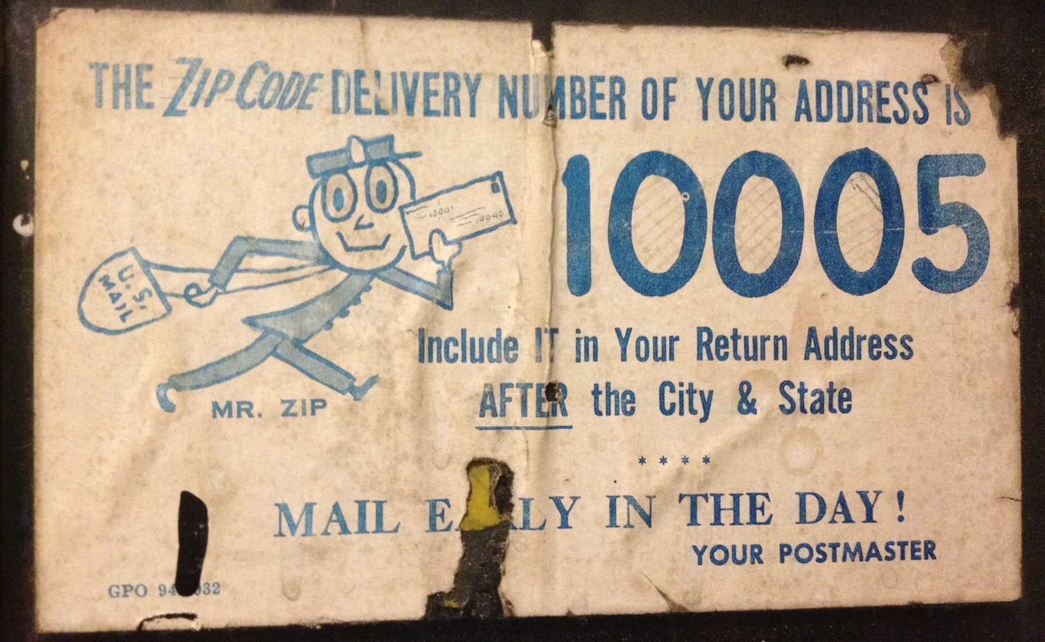
Image credit: United States Postal Service advertisement for ZIP Code 10005 by Brianga.