16 April 2026
OpenStreetMap: where the map meets the territory
We want to occasionally use this blog to shine a light on projects we support and genuinely think are doing good, important work. These are not product announcements or partner spotlights in the usual sense but are closer to profiles of the tools, communities, and infrastructure that help make our own work possible. OpenStreetMap felt like an obvious place to start.
OpenStreetMap (OSM) is a free, editable map of the world, built and maintained by a global community of contributors. It is often described as the “Wikipedia of maps,” but in practice it functions as something closer to infrastructure: a shared dataset that many other mapping tools and services are built on top of.
The project began in 2004 as a response to the cost and restrictions of proprietary geographic data. Instead of relying on government agencies or private companies to define the world, OSM took a different approach: let people map it themselves.
Today, that approach underpins a large part of the modern geospatial ecosystem. At Geocode Earth, OpenStreetMap is one of the core datasets we rely on. It forms a significant part of the raw geographic data that gets transformed into something searchable and usable through geocoding.
Millions of contributors map everything from international boundaries to individual benches and trees, and all that data is freely available for anyone to use, modify, and build on.
Mapping from below
What makes OpenStreetMap distinct is not just that it is open, but how the data is created. Rather than being centrally produced, it is built through a mix of local knowledge and shared tools:
- people surveying their surroundings on foot, bike, or car
- contributors tracing roads and buildings from satellite imagery
- public datasets being incorporated where licensing allows
- lightweight contributions through apps that ask simple, local questions
The underlying assumption is a straightforward one: the people closest to a place are often the ones who know it best. And that, to me, is the interesting part. Because it means the map carries more than infrastructure. It also reflects the people who live there, and how places are actually known and used.
In Brisbane, where I’m from, right in the middle of Queen Street Mall, there is a Hungry Jack’s (Burger King to the rest of the world). If you are meeting someone in the city, that is invariably the meeting point. There is no question about it. It’s like the city-wide assembly point after a fire alarm. By now it’s less a fast food outlet than a civic landmark.
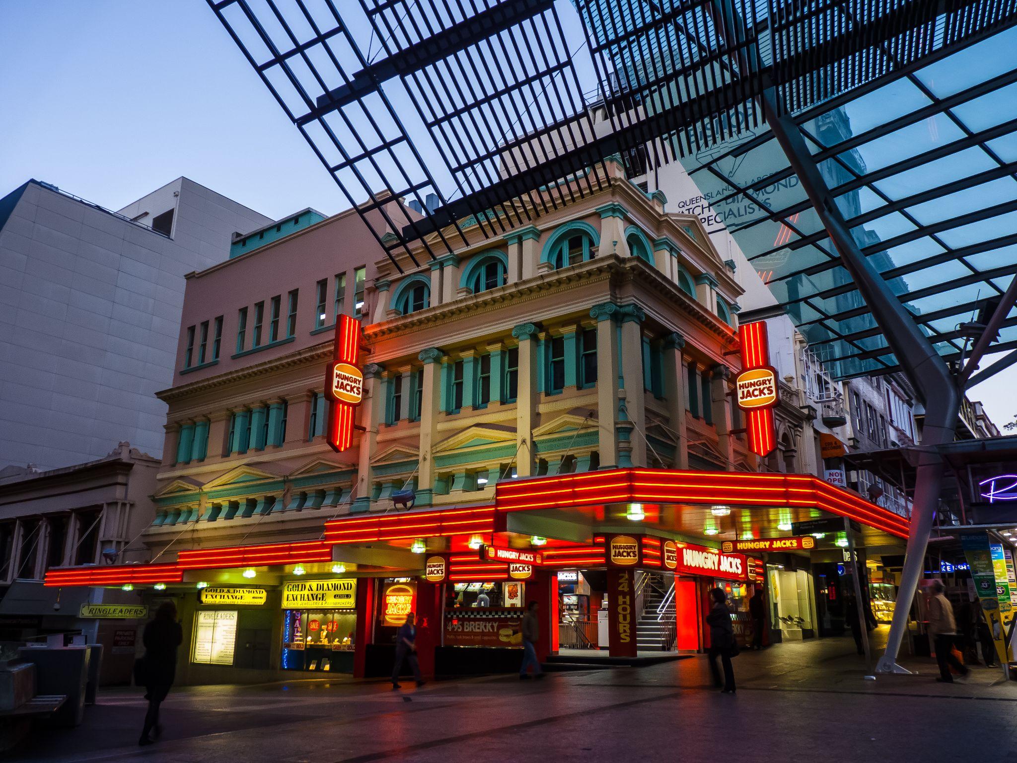
It has this slightly absurd, mythic status. The place that becomes important not because of some brilliant piece of city planning, but because people kept using it until it lodged itself in the shared mental map of the city.
The most arbitrary things can take on significance like that. That is what OSM leaves room for: the way a place changes through use, repetition, and habit.
When it matters most
It reminds me a bit of desire paths.
Cities are designed one way, but then thousands of people walk a different route often enough that a new path gets worn into the ground. And if the city is smart, eventually it gives up and builds the path people were already taking.
OpenStreetMap works in a similar way. It captures the routes, structures, and knowledge that emerge from the ground up, rather than waiting for a central authority to define them.
And in some situations, that can make an enormous difference.
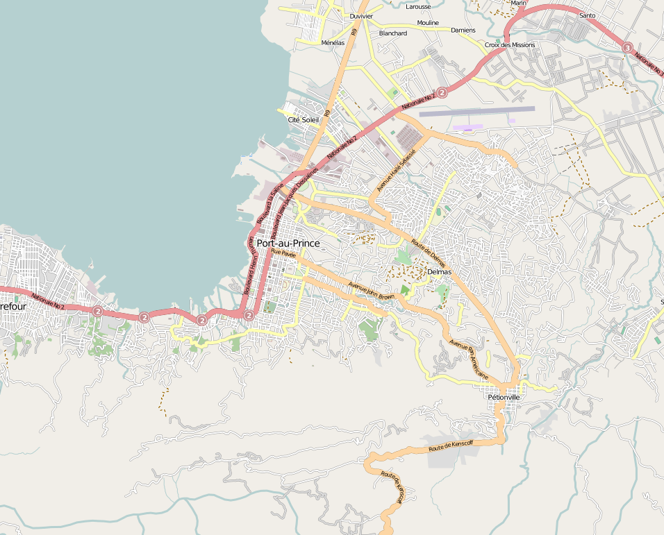
After the 2010 Haiti earthquake, volunteers from around the world used OpenStreetMap to map large parts of Port-au-Prince in a matter of days. Roads, buildings, and refugee camps were added at a pace that would have been difficult for any centralised organisation to match. The result was one of the most detailed and up-to-date maps available to responders on the ground, and in many cases, it was better than the official data.
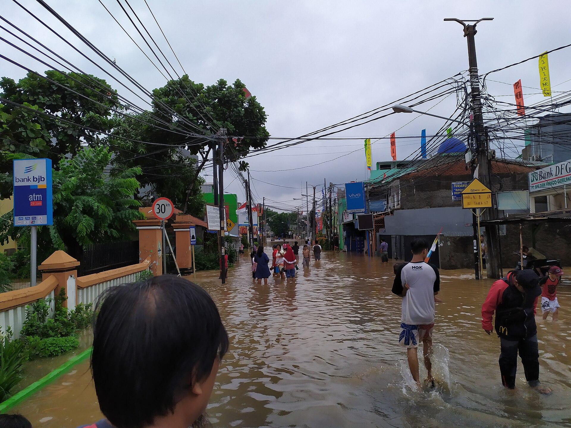
Similar patterns have played out in Jakarta. After major flooding, local communities and volunteers mapped large parts of the city using OSM. The data became useful enough that government agencies began using it for disaster planning and response, feeding into tools like InaSAFE.
And it’s not limited to large-scale disasters. In a number of cases, local councils and agencies have compared their own datasets to OpenStreetMap and found gaps or outdated information in their systems. In some cases, they adopt OSM directly. In others, they use it to update their own records.
Which is kind of a strange inversion. You would expect governments to have the most complete and up-to-date view of the world. But in practice, those systems are often slower to update, constrained by budgets, or locked into long procurement cycles. Whereas OpenStreetMap is continuously updated by people on the ground. Changes can happen the same day. People map what they actually see.
And sometimes, that turns out to be the more accurate picture.
A map with fingerprints
Of course, this approach does have its tradeoffs. A more human map will share some of those same idiosyncrasies.
OpenStreetMap is not perfectly consistent. Coverage varies from place to place. Some areas are mapped in extraordinary detail, while others remain sparse. Small errors and inconsistencies creep in, and different contributors may describe the same thing in different ways.
But that’s part of its character, part of the charm of the whole endeavour. OSM is not trying to present a perfectly uniform view of the world. It is a living dataset, shaped by the people who contribute to it, and the data carries the marks of that process.
It has the smudged fingerprints of human beings all over it.
And in a world that increasingly feels overly technical, flattened, and impersonal, there is something compelling about a piece of technical infrastructure that still feels so connected to the communities it represents. It is uneven, constantly changing, and sometimes messy.
But that is what makes it feel alive. It is not a finished map of the world so much as an ongoing attempt to keep pace with it.

.jpg)
Image credit: Port-au-Prince, Haiti in OpenStreetMap.